


CycleStreets journey planner app for iPhone and iPad
Developer: CycleStreets Ltd
First release : 21 Sep 2010
App size: 28.5 Mb
UK-wide cycle journey planner CycleStreets on your mobile device! Cycle journey planner for cyclists, by cyclists.
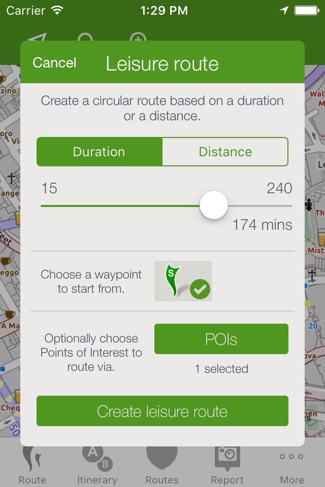
Plan routes from A to B anywhere in the UK, with a choice of three routing modes to suit a range of cyclists from beginner to regular commuter, plus a circular leisure routing mode. And the Photomap lets you submit photos of infrastructure problems or good practice around the UK.
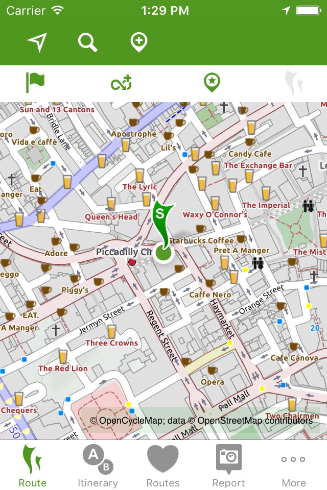
PLAN CYCLE ROUTES FROM A TO B (TO C, D, ..)
Select a start and finish point by clicking on the map, by searching for names/places/postcodes, or by using your current location, and click to obtain the route.
CHOICE OF THREE ROUTING MODES
The app produces routes that will suit most cyclists. It can optionally can find faster or quieter routes for different types of rider. Routes are fetched from the CycleStreets website. You can switch the route type after planning it, and can save and rename and organise routes.
HILLS? NO PROBLEM!
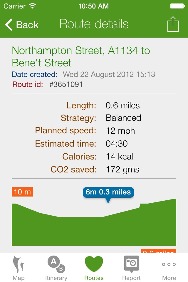
The journey planner knows about hills, and finds routes that take advantage of the descents and avoids the ascents where possible. It balances these against the available road types. The route can be displayed on a map with contours using the OpenCycleMap option.
STAGE-BY-STAGE ITINERARY
As well as the main map view, planned routes are loaded into an itinerary view, so you can follow each part of the journey. The street name, time and length are all shown, as is a detailed map for each individual stage of the journey. Routes are saved so you can also follow them again later.
PHOTOMAP
The Photomap is a cycling advocacy tool used by campaign groups around the country. Use it to browse examples of problems or good practice, and add your own pictures. Need more cycle parking in your favourite spot in town? Sign in with a free account and add a photo of it to the Photomap.
OPENSTREETMAP
Routing makes use of OpenStreetMap data, the brilliant geo-wiki to which you can contribute. Note that, at present, some areas of the country have better coverage than others. Streets and paths of all kinds, including Sustrans routes and Local Authority network, are included. Routing quality is being developed all the time, with new types of cycling and street data being added and interpreted by the route planner.
Thanks to Neil Edwards for his hard work on this release.
Latest reviews of CycleStreets journey planner app for iPhone and iPad
The app doesnt work. Not very clear how to add points. Does not seem to support a landscape display on iPad. When I did manage to get a few points laid down on my map kept getting an error regarding invalid data. Perhaps this app is only designed to work in the UK.?
I cant believe that the program is absolutely free. This program is very good overall. However, One thing I dont like about the program is that the map doesnt scroll as i move, which frustrates me so much. So I would rate this 4 out of 5. Greeting from Japan
I like using the open street map data, but this app doesnt work for me. It waits forever when I try to crest a route in Oregon, USA, and it dies often.
Im pretty familiar with London, but thats not always the same as finding the best or quietest cycle route. Before this app, I used to ride on the roads I was most familiar with, which also happened to be the busiest routes with the most busses and cars. Now, Im able to discover quieter, safer and overall much nicer routes to ride. This is brilliant as it has really increased my joy of cycling through central London. Well done guys!!
Doesnt work in Texas. Pity. Red a nice review that made it sound like a smarter cycling router than Google maps.